Transform an equirectangular map image using one of the numerous supported global or regional map projections, with this useful macOS app #View map #Transform map #Map projection #Map #Projection #Overlay
As any geographer will tell you, it is impossible to depict the globe's surface on a flat plane accurately, as the resulting image is bound to distort the source data in some way. This is why there are so many different projection algorithms available, as they are each used to create maps best suited for specific purposes.
G.Projector can convert maps between numerous global or regional map projections, draw longitude-latitude gridlines and export the generated images to various formats.
While the app can be useful for scientific or educational purposes, we can recommend it to any user, if only to gain a better understanding of the pros and cons of various projection methods.
When G.Projector is launched, it brings up a dialog window asking you to locate and insert a source map file. The app supports the BMP, GIF, JPG or PNG formats and can also identify ground overlay images within OpenGIS KML and KMZ files.
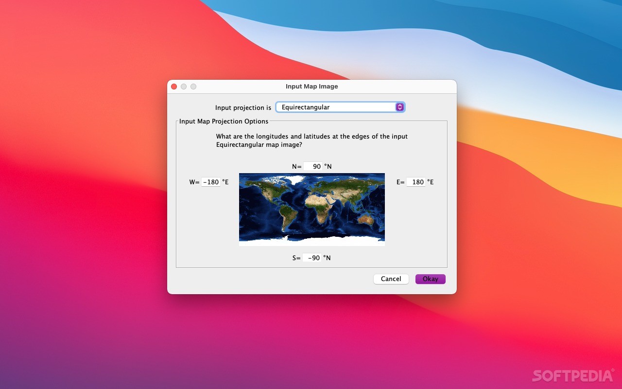
You can then enter the latitude and longitude lines that define the edges of the imported map.
To begin with, you may wish to cycle between the multiple available projection types, as it can be very interesting to see how they warp certain areas of the map.
Afterward, you can modify various settings, such as the color of continental outlines and political boundaries or the latitude and longitude at which the map should be centered.
You can then save the altered maps to several image or document formats, including JPEG, GIF, PNG, TIFF and PDF.
G.Projector is also quite user-friendly, as importing a map file and switching between various projections is a simple task. If would, however, be helpful if the map window could be resized, as working with multiple images at the same time would be a lot easier.
To sum it all up, G.Projector is an interesting app that anyone can download and try at least once, as understanding how various map projections warp geographical data can be very important.
G.Projector is also easy-to-use and comes equipped with several sample files, in case you do not have access to a supported equirectangular map image.
What's new in G.Projector 2.6.1:
- Added Canters Polyconic W07 as a variant of Wagner VII.
- Added Compressed variant to Wagner IX.
- Bugfix: Sorting of Roman numerals in projection list.
G.Projector 2.6.1
add to watchlist add to download basket send us an update REPORT- runs on:
- OS X 10.7 or later (Universal Binary)
- file size:
- 18.5 MB
- filename:
- G.ProjectorMacOS-2.6.1.dmg
- main category:
- Math/Scientific
- developer:
- visit homepage
Windows Sandbox Launcher

4k Video Downloader

Context Menu Manager

7-Zip

calibre

Microsoft Teams

IrfanView

Bitdefender Antivirus Free

Zoom Client

ShareX

- Bitdefender Antivirus Free
- Zoom Client
- ShareX
- Windows Sandbox Launcher
- 4k Video Downloader
- Context Menu Manager
- 7-Zip
- calibre
- Microsoft Teams
- IrfanView