A Digital Elevation Model viewer for the macOS that can be used to browse different types of maps and includes support for Bird's-eye or Panorama viewing modes. #View map #DEM viewer #Map viewer #Browser #Map #DEM
Digital Elevation Models usually provide 3D representations for various surfaces and can be used to store elevation details about a certain area on a map.
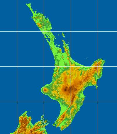
Moreover, SimpleDEMViewer is a fairly easy to use Mac app that enables you to visualize and navigate the information stored in this type of files.
Note that SimpleDEMViewer provides only viewing tools, so to get started, you must first import a DEM file: go to the File Menu and press the Open entry.
SimpleDEMViewer is able to open all sorts of file types that include digital elevation models: GTOPO30, ETOPO1, ETOPO2, ETOPO5, HYDRO1K, SRTM, SRTM DTED, SRTM30plus, GLOBE, GDEM and much more. A complete list is included in the SimpleDEMViewer online manual.
SimpleDEMViewer allows you to browse the elevation data and visualize the map representation in its main window. Moreover, you can refresh the rendition or choose to zoom in or out the images (via the Map Handling menu or by using the Command + [ or Commend + ] hotkeys).
At the same time, you can adjust the viewing mode (bird’s eye or panorama), the map’s texture, contour or slope level. Other options include the possibility to generate stereographs, geo profiles, projection / grayscale maps or lake data.
Through the SimpleDEMViewer Preferences window the user can adjust the color set for the elevation representation, toggle the shading effects or the latitude and longitude lines. One can also set up the default measurement unit (km, mile nautical mile) or the base latitude for the map width calculation.
SimpleDEMViewer also comes with a fairly simple user interface but is able to use the DEM file to generate different types of maps projections: Conical, Mercator, Azimuthal Equidistant, Azimuthal Equal-Area or Orthographic.
What's new in SimpleDEMViewer 8.0.1:
- Correct following issues:
- Could not change lake data folder.
- Preferences panel behaved oddly under stage manager or full screen mode.
- "Other scale" menu showed 400% always in SRVC Relief Map dialog.
SimpleDEMViewer 8.0.1
add to watchlist add to download basket send us an update REPORT- runs on:
- macOS 12.0 or later (Universal Binary)
- file size:
- 11.2 MB
- filename:
- SDVr_801.zip
- main category:
- Math/Scientific
- developer:
- visit homepage
4k Video Downloader

paint.net

Windows Sandbox Launcher

Bitdefender Antivirus Free

IrfanView

ShareX

7-Zip

Zoom Client

Microsoft Teams

calibre

- Zoom Client
- Microsoft Teams
- calibre
- 4k Video Downloader
- paint.net
- Windows Sandbox Launcher
- Bitdefender Antivirus Free
- IrfanView
- ShareX
- 7-Zip