Gain a clear situation about the locations you shoot your photos with the help of this professional photo geo-tagging and annotation tool. #Geotag photo #Photo annotation #GPS database #Geotagger #Geotag #Annotation
PhotoLinker provides a GPS track database and browser. Saved track files can be imported from the computer or downloaded directly from a GPS receiver.
Tracks are automatically cataloged by date and displayed on an interactive map where the size and color can be adjusted. The track browser handles years of data and millions of track points.
PhotoLinker's metadata editor is completely customizable so it facilitates a streamlined and efficient workflow.
PhotoLinker complies with recently released (9/2008; rev 2/2009) recommendations of the Metadata Working group MWG [metadataworkinggroup.org/].
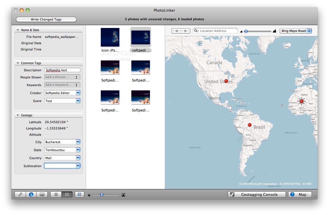
PhotoLinker is an interactive geotagging tool.
Photos can be automatically geotagged by matching them to a GPS track. Proposed linking points are displayed on a map and updated as criteria are changed.
Photos can also be manually geotagged by pinpointing a location on a map, entering the coordinates manually, or tagging them to waypoints.
All three modes save latitude and longitude to the photo (and altitude when available). You choose whether the city, state, country and elevation are saved to the photo in PhotoLinker preferences.
PhotoLinker queries either google.com [maps.google.com] (default), Microsoft's Terraserver [terraserver-usa.com] or geonames.org to find the city, state and country corresponding to the latitude and longitude data.
System requirements
- 64-bit processor
Limitations in the unregistered version
- 30 days trial
PhotoLinker 3.5.10
add to watchlist add to download basket send us an update REPORT- runs on:
- OS X 10.9 or later (Intel only)
- file size:
- 12.5 MB
- filename:
- PhotoLinker.zip
- main category:
- Graphics
- developer:
- visit homepage
IrfanView

Bitdefender Antivirus Free

Zoom Client

Microsoft Teams

7-Zip

ShareX

calibre

Context Menu Manager

Windows Sandbox Launcher

4k Video Downloader

- Context Menu Manager
- Windows Sandbox Launcher
- 4k Video Downloader
- IrfanView
- Bitdefender Antivirus Free
- Zoom Client
- Microsoft Teams
- 7-Zip
- ShareX
- calibre