Spatial imaging tools for Adobe Photoshop. #Spatial imagery #Adobe Photoshop plug-in #Manipulate image #Map #Import #Manipulate
Working with raster imagery does not have to be complicated. Geographic Imager is a user-friendly mapping software that lets you use Adobe Photoshop for easily working with spatial imagery.
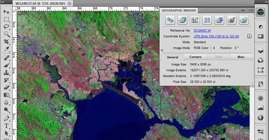
Geographic Imager adds tools to import, edit, manipulate and export geospatial images such as aerial and satellite imagery.
Enjoy the use of native Adobe Photoshop functions such as transparencies, filters, pixel editing, and image adjustments like brightness, contrast, and curve controls while maintaining spatial referencing.
Geographic Imager supports GeoTIFF in Adobe Photoshop and other industry standard raster formats. Mosaic and tile images, change projections, transform, rectify and georeference images based on ground control points.
Batch-process your imagery using Geographic Imager and Adobe Photoshop scripting capabilities. Geographic Imager is a great companion to MAPublisher for Adobe Illustrator - prepare images in Geographic Imager and use them in MAPublisher.
Also, please note that Geographic Imager has the following characteristics: · Fully compatible with Adobe Photoshop CS5.1 (also known as Photoshop 12.1 in Adobe CS5.5) · New Pixel-As-Point option: A new preference is available when saving GeoTIFF images. The Pixel-As-Point reference method option uses the center of the pixel as the reference point. · New Create Single Layer option in Terrain Shader: A new option in Terrain Shader creates a single colorization layer when multiple DEM layers are present. · Various bug fixes and performance improvements
System requirements
- Adobe Photoshop CS3** / CS4 / CS5
- 2 GB of RAM (4 GB recommended)
- 300 MB of available hard-disk space
- DVD-ROM drive
What's new in Geographic Imager 5.0:
- Fully compatible with Adobe Photoshop CC 2015
- Redesigned Georeference tool: reference with online maps, coordinate system detection, and improved rectification process
- New export DEM formats: ArcInfo ASCII Grid and BIL
- New online help and help integrated into dialogs
Geographic Imager 5.0.1
add to watchlist add to download basket send us an update REPORT- runs on:
- Mac OSX 10.5 or later (Intel only)
- file size:
- 222.6 MB
- filename:
- GI501mac.dmg
- main category:
- Graphics
- developer:
- visit homepage
ShareX

Context Menu Manager

IrfanView

Windows Sandbox Launcher

Zoom Client

Microsoft Teams

7-Zip

Bitdefender Antivirus Free

calibre

4k Video Downloader

- Bitdefender Antivirus Free
- calibre
- 4k Video Downloader
- ShareX
- Context Menu Manager
- IrfanView
- Windows Sandbox Launcher
- Zoom Client
- Microsoft Teams
- 7-Zip