Quickly add geo location tags to your images via an user friendly macOS application that is based on the ExifTool open source project. #Geo location tag #Geotag image #Geo location metadata #Geotag #Geo location #Metadata
GeoTag is a minimalist macOS application that can help you embed geolocation metadata to your images files without dealing with a complicated workflow. Noteworthy is that GeoTag is using the ExifTool open source application for the geotagging, which you must install separately.
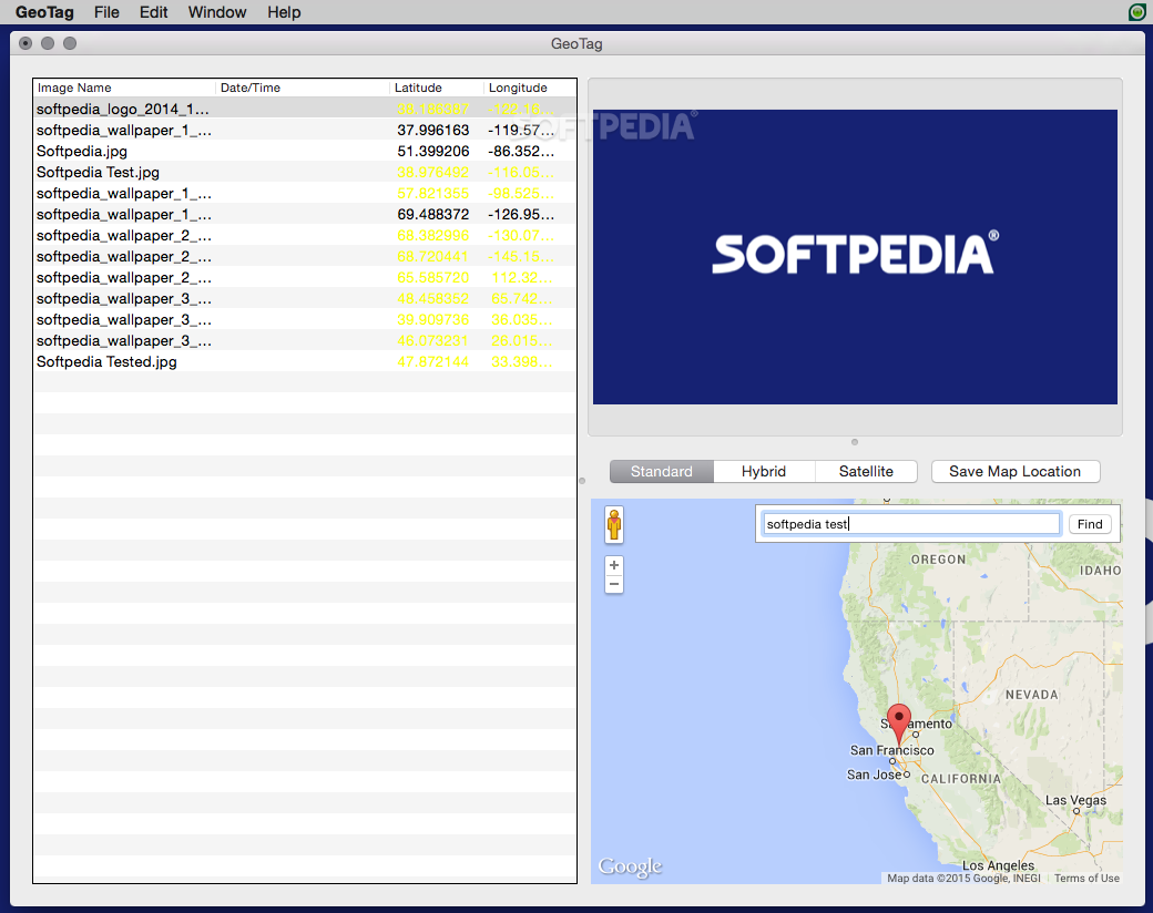
The GeoTag user interface is represented by a single window where you can see the list of imported files that are to be processed. In the image well area you can preview the currently selected picture, and you can navigate to various locations in the map section.
GeoTag is using the Google Maps service and allows you to see the maps in standard, hybrid, or satellite mode. You can easily zoom in and zoom out, you can use the search tool to browse to specific locations at once, and you have the option to save the map position when dealing with a frequently used area.
To add geolocation information to an image file just navigate to the respective location on the map and click to set up a pin. To modify the geotag drag the pin on the map. If you are not satisfied with the result, GeoTag comes with support for Undo and Redo actions.
The app allows you to batch geotag images to save time when dealing with large image collections. To complete the procedure, make sure to save the changes before closing the application. The original files are sent to the trash while the geotagged images replace them on the spot.
GeoTag provides a user-friendly GUI for the open source ExifTool application that comes with a command line interface. The app offers you the possibility to embed geolocation information to your files through intuitive drag and drop actions, and even includes batch processing capabilities.
What's new in GeoTag 5.2:
- Updated for macOS Sonoma.
- A major performance bottleneck found in previous versions has been found and fixed.
- Timestamp and location editing from keyboard is now done using an inspector panel.
- The displayed image thumbnail is now larger for those who may run in the app in full screen mode.
GeoTag 5.2
add to watchlist add to download basket send us an update REPORT- runs on:
- macOS 14.0 or later (Universal Binary)
- file size:
- 6.5 MB
- filename:
- GeoTag-5.2.dmg
- main category:
- Graphics
- developer:
- visit homepage
7-Zip

Microsoft Teams

calibre

4k Video Downloader

Zoom Client

IrfanView

Bitdefender Antivirus Free

Windows Sandbox Launcher

Context Menu Manager

ShareX

- Windows Sandbox Launcher
- Context Menu Manager
- ShareX
- 7-Zip
- Microsoft Teams
- calibre
- 4k Video Downloader
- Zoom Client
- IrfanView
- Bitdefender Antivirus Free